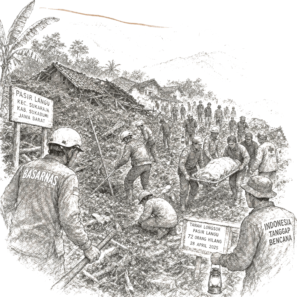
Rescuers in Indonesia’s West Java province searched for 72 missing residents Sunday after a predawn landslide Saturday buried approximately 34 houses in Pasir Langu village and killed at least 25 people, according to the National Search and Rescue Agency.
The landslide struck on the slopes of Mount Burangrang, covering an area stretching more than 2 kilometers with mounds of mud up to 5 meters high. About 230 residents living near the site were evacuated to government shelters.
The disaster has intensified scrutiny of land-use enforcement in a protected conservation zone. Environmental activists say the landslide resulted from years of development that violated spatial-planning regulations in a region already designated as a critical water-catchment zone.
Search and Recovery Operations
Rescuers worked through Sunday’s improved weather to pull bodies from the mud. A 250-member search team collected victims’ remains, including body parts, in 14 body bags as they dug through the debris of buried homes. Ade Dian Permana, head of the local search and rescue office, said the loose ground on the slope prevented the use of heavy equipment.
“Some homes are buried up to the roof level,” Permana said.
The National Search and Rescue Agency deployed drones and K-9s to locate additional bodies along the landslide path. The agency’s head, Mohammad Syafii, said teams would continue operations around the clock as long as conditions allowed, though rescue officials warned that more rain could further destabilize the slope.
Environmental Causes
Wahyudin Iwang of Walhi West Java, an Indonesian environmental group, said the landslide reflected broader environmental challenges in a region governed by spatial-planning regulations. The area where the landslide occurred is part of the North Bandung Area, a protected conservation zone spanning about 38,543 hectares across four cities and regencies in West Java.
“This landslide is the accumulation of activities that were not in line with spatial planning and environmental functions,” Iwang said.
The protected highland area functions as a critical water-catchment zone and environmental buffer for the Bandung Basin, one of Indonesia’s most densely populated regions. Iwang and other environmental activists said years of land conversion for development had violated land-use regulations intended to preserve the zone’s environmental function.
Official Response
Indonesian Vice President Gibran Rakabuming Raka visited the affected area on Sunday and pledged that authorities would take measures to prevent similar disasters. He directed local authorities in West Bandung district to address “the issue of land conversion in disaster-prone areas” and to reduce risks in the region.
Indonesia faces recurring hazards from seasonal rains and high tides from October to April, which frequently cause flooding and landslides across the archipelago of more than 17,000 islands where millions of people live in mountainous terrain or near fertile floodplains.